This year is expected to be the busiest on record for holiday travel, but rough weather in the West and the East may make getting to and from your Christmas destination even harder.
As a life-threatening storm begins in California, here’s a look at the Christmas weather forecast:
California
More than 41 million people across nearly all of California — including Los Angeles, San Francisco, Sacramento and San Diego — as well as parts of Nevada and Arizona are under a flood watch on Christmas Eve.
A rare alert for «high risk for excessive rainfall» is in place Wednesday for Los Angeles and the surrounding area, so those traveling on Christmas Eve and Christmas Day should be extremely careful on the roads. Road flooding, rockslides, mudslides and water rescues are possible.
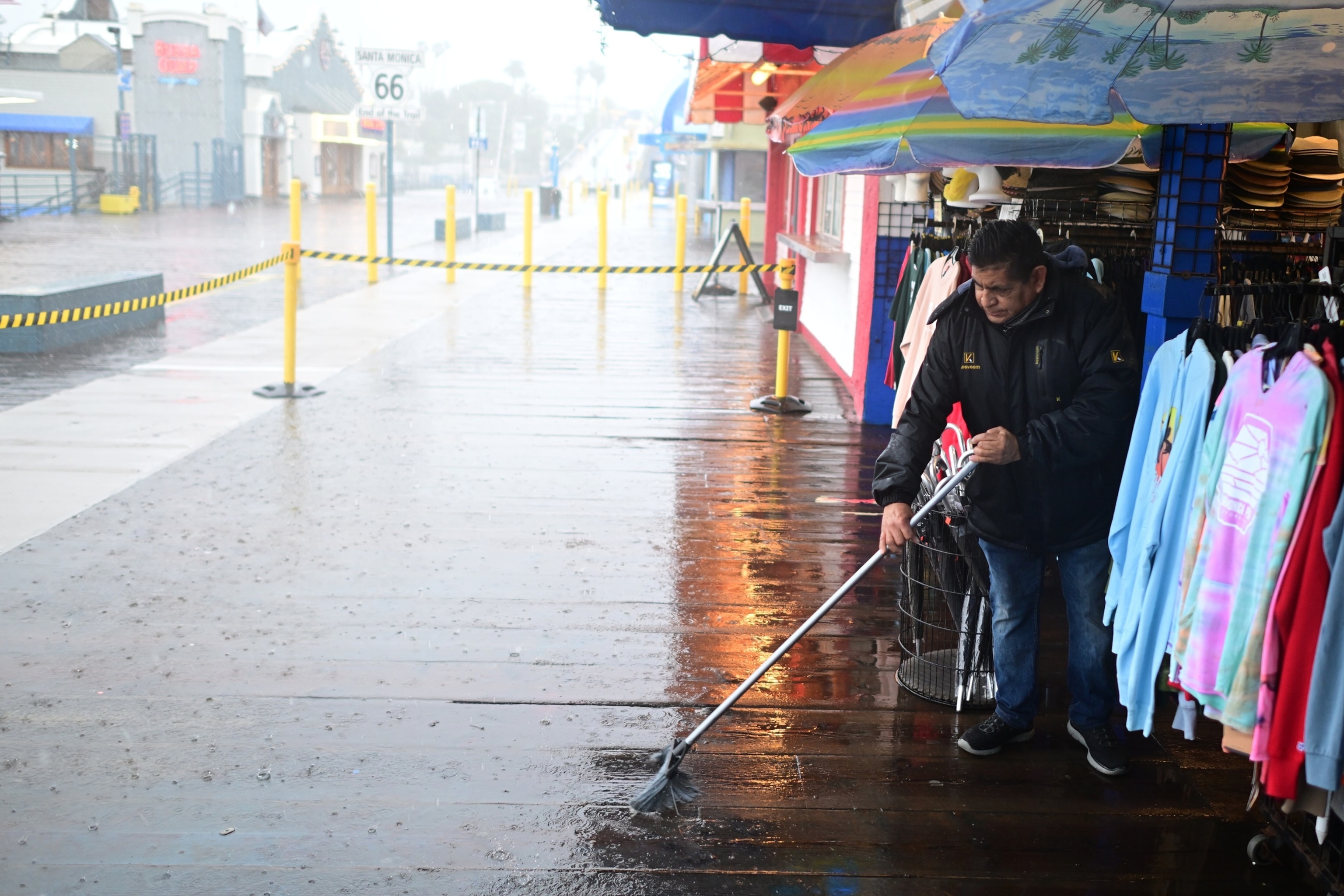
Miguel Lopez sweeps rainwater from Marlene’s Beachcomber on the Santa Monica pier, Dec. 24, 2025, in Santa Monica, Calif.
Wally Skalij/AP
The pounding rain is now underway in Southern California and will continue until around 6 p.m. local time Wednesday.
With rainfall rates possibly topping 1 inch per hour, higher elevations surrounding LA can expected 5 to 10 inches of rain on Wednesday alone.
Wind gusts will reach 40 to 50 mph on Wednesday, potentially causing power outages. Thunderstorms are also possible, as well as brief tornadoes along the California coast.
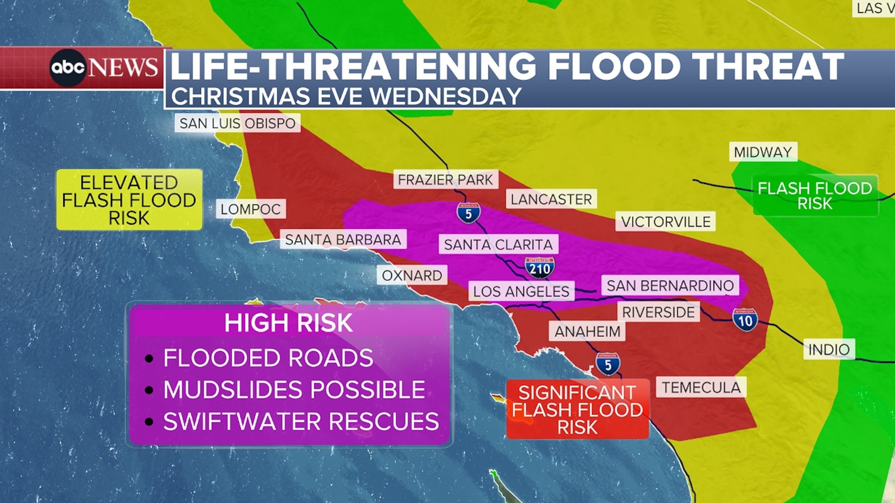
Life-threatening flood threat.
ABC News
The rain will take a break Wednesday evening before picking back up overnight.
More rounds of rain will hit on Christmas Day and Friday, prolonging the threat of flooding, mudslides and landslides.
Popular Reads
By Friday, rain totals could reach 4 to 7 inches along Southern California’s coasts and valleys, and 6 to 14 inches is possible in the foothills and mountains.
Some residents are under evacuation warnings. California Gov. Gavin Newsom has issued a state of emergency in Los Angeles, Orange, Riverside, San Bernardino, San Diego and Shasta counties.
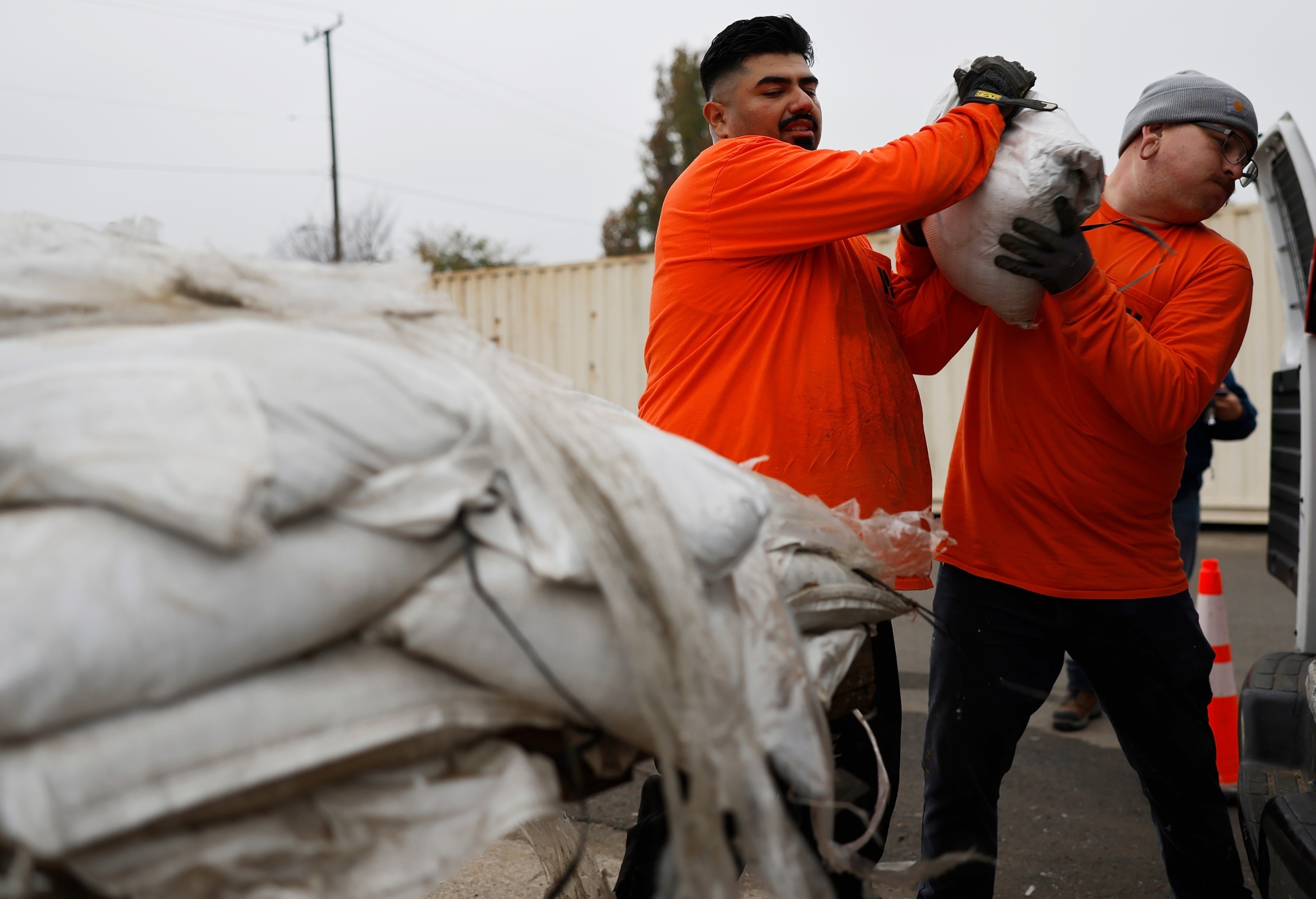
Los Angeles County workers load sandbags for a resident, near the Eaton Fire burn zone, in preparation for a strong atmospheric river storm arriving today to the region, on Dec. 23, 2025, in Altadena, Calif.
Mario Tama/Getty Images
Northeast
Meanwhile, a new storm is forecast to hit the Northeast on Friday, coating roads with snow, sleet, freezing rain and ice, making driving home after Christmas extremely treacherous. Expect dangerous commutes on Interstate-80, I-70, I-90 and I-95.
The storm will bring ice to Michigan, Ohio and then Pennsylvania, potentially causing travel chaos and leaving widespread power outages. Ice accumulation could reach a quarter inch or thicker in some areas.
Further east, the storm will bring snow. Six to 12 inches is possible in western New York, northeastern Pennsylvania and parts of New Jersey and Connecticut.
This storm is also forecast to bring the biggest snowfall of the season to New York City. The snow will fall in New York from Friday night to Saturday morning and could reach 4 to 6 inches.
